Sellafield
54.4333°N, -3.495°E|Nuclear DecommissioningSellafield in Cumbria is Europe’s most complex nuclear decommissioning site, managing decades of legacy waste and hundreds of buildings across a sprawling coastal complex. The NDA’s £4.9m Condition Monitoring pipeline specifically targets automated surveillance of this site. Current monitoring relies on manual inspection cycles with significant gaps in temporal coverage.
Same-season comparison (August 2024 vs July 2025) using Sentinel-2 NDVI analysis. The 33.1% anomalous change rate reflects ongoing decommissioning activity, facility modifications, and environmental changes across the complex. Anomaly threshold of ±0.08 NDVI isolates genuine year-on-year change.
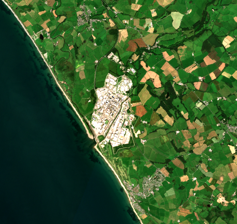
The Sellafield complex (white/grey) dominates the Cumbrian coastline. The scale of Europe’s most complex decommissioning site is immediately apparent from space. Irish Sea to the west, farmland to the east.
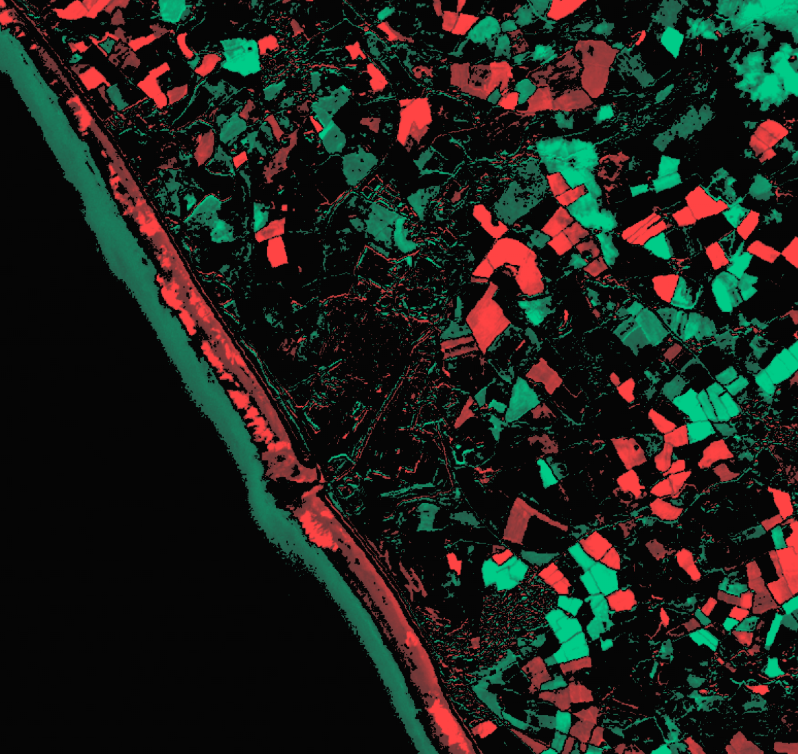
33.1% of pixels show genuine change between summers. The complex itself and its coastal buffer show the highest change rates — consistent with active decommissioning and coastal dynamics.
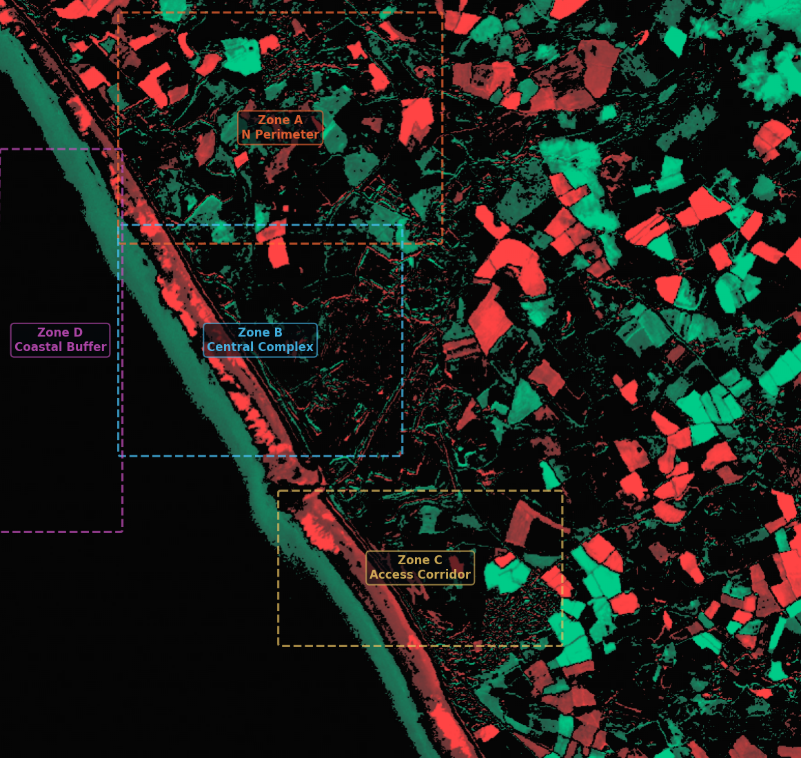
Zone D (Coastal Buffer) at 43.6% is the most active. Zone C (Access Corridor) at 10% is the most stable. This pattern is consistent with known site operations.
33.1% of monitored pixels (187,984 out of 568,075) show anomalous change. The coastal buffer zone shows the highest anomaly rate (43.6%) driven by coastal erosion and facility-adjacent changes. The NW perimeter shows 39.7% anomalous change consistent with ongoing decommissioning works. The access road area is relatively stable at 10.0% (AMBER), suggesting completed infrastructure.
Sellafield is the direct procurement target for the NDA’s £4.9m Condition Monitoring pipeline. This analysis demonstrates that satellite monitoring can detect and quantify decommissioning-related surface changes at the site, providing continuous 12-day oversight between manual inspections. The ITT closes April 2026 with award expected July 2026.
Highest anomaly rate on site (43.6%). Combination of coastal dynamics and facility-adjacent surface changes.
39.7% anomalous. Active decommissioning zone with significant surface disturbance year-on-year.
28.8% anomalous. Core facility modifications detected in the main complex area.
33.1% anomalous change at Sellafield — the NDA’s primary condition monitoring target
Good confidence despite T1 scene having 12% cloud cover. Same-season methodology is robust. 33.1% anomalous rate is consistent with known decommissioning activity.
Highest anomaly rate on site (43.6%). Combination of coastal dynamics and facility-adjacent surface changes.
39.7% anomalous. Active decommissioning zone with significant surface disturbance year-on-year.
28.8% anomalous. Core facility modifications detected in the main complex area.
Result produced by established remote sensing techniques (NDVI, band math). Well-proven, peer-reviewed methods.
Discovery Phase capability. Uses AI foundation models or requires ground-truth calibration. Indicates direction of travel.